Currently Empty: ₹0.00

Geography Books for Competitive Exams
Geography is the study of the Earth, its physical features, climate, resources, population, economic activities and the relationship between people and their environment. It helps students understand questions such as:- How are mountains and plains formed?
- Why do different regions experience different climates?
- How do rivers shape landscapes?
- Why are some regions densely populated while others are sparsely populated?
- Where are important minerals and resources found?
- How does agriculture depend on soil, rainfall and climate?
- Why do industries develop in particular locations?
- How do human activities affect the environment?
- Physical Geography
- Geomorphology
- Climatology
- Oceanography
- Human Geography
- Economic Geography
- Population Geography
- Settlement Geography
- Agricultural Geography
- Industrial Geography
- Environmental Geography
- Indian Geography
- Rajasthan Geography
- Cartography
- Remote Sensing
- GIS
Why Geography Matters in Competitive Exams
Geography is an important subject in many government, teaching and academic examinations. Candidates may encounter Geography in:- RPSC RAS
- RPSC School Lecturer
- RPSC 1st Grade Teacher
- RPSC Assistant Professor
- UPSC Civil Services
- UGC NET Geography
- SLET Geography
- College Lecturer examinations
- University entrance examinations
- Other government and subject-based examinations
- Indian rivers
- Mountains
- Climate
- Agriculture
- Natural resources
- Population
- Rajasthan Geography
- Geographical theories
- Geomorphological processes
- Climatology
- Human Geography
- Economic Geography
- Models and theories
- Quantitative techniques
- Remote Sensing
- GIS
Begin with the Earth
A strong Geography foundation begins with understanding the Earth itself. Students may study:- Shape of the Earth
- Size of the Earth
- Rotation
- Revolution
- Latitude
- Longitude
- Time zones
- Seasons
Latitude and Longitude
Latitude and longitude help identify locations on Earth's surface.Latitude
Latitude measures angular distance north or south of the Equator. Important latitudes may include:- Equator
- Tropic of Cancer
- Tropic of Capricorn
- Arctic Circle
- Antarctic Circle
Longitude
Longitude measures angular distance east or west of the Prime Meridian. Longitudes are especially important for calculating time. Students should understand why places located at different longitudes experience different local times.Earth’s Interior
Physical Geography requires an understanding of Earth's internal structure. Major layers include:- Crust
- Mantle
- Core
- Lithosphere
- Asthenosphere
- Earthquakes
- Volcanoes
- Mountain building
- Plate movement
Plate Tectonics
Plate Tectonics is one of the most important concepts in Physical Geography. Earth's lithosphere is divided into plates that move slowly. Different plate boundaries include:- Convergent boundaries
- Divergent boundaries
- Transform boundaries
- Mountain formation
- Ocean trenches
- Mid-ocean ridges
- Earthquakes
- Volcanoes
Mountains
Mountains can form through different geological processes. Students may study:- Fold mountains
- Block mountains
- Volcanic mountains
- Residual mountains
Earthquakes
Earthquakes occur because of sudden release of energy within the Earth. Important terms may include:- Focus
- Epicentre
- Seismic waves
- Fault
Volcanoes
Volcanoes occur when molten material and gases reach or approach Earth's surface. Students may study:- Active volcanoes
- Dormant volcanoes
- Extinct volcanoes
- Volcanic landforms
- Mountains
- Plateaus
- Islands
- Fertile soils
Rocks
Rocks form the basic material of Earth's crust. They can broadly be divided into:- Igneous rocks
- Sedimentary rocks
- Metamorphic rocks
Igneous Rocks
Form from cooling and solidification of molten material.Sedimentary Rocks
Form through deposition, compaction or chemical processes.Metamorphic Rocks
Form when existing rocks are transformed under heat and pressure. Students should understand the rock cycle. One rock type can gradually change into another under suitable conditions.Geomorphology
Geomorphology studies landforms and the processes responsible for creating them. Important processes may include:- Weathering
- Erosion
- Transportation
- Deposition
- Rivers
- Wind
- Glaciers
- Groundwater
- Sea waves
Weathering and Erosion
Students often confuse weathering and erosion.Weathering
Weathering breaks down rock at or near its original location.Erosion
Erosion involves the removal and transportation of weathered material. Weathering may be:- Physical
- Chemical
- Biological
River Landforms
Rivers are major agents of erosion, transportation and deposition. Students may study:- V-shaped valleys
- Waterfalls
- Meanders
- Oxbow lakes
- Floodplains
- Deltas
Desert and Wind Landforms
Wind plays an important geomorphic role in dry regions. Students may study:- Sand dunes
- Deflation hollows
- Mushroom rocks
- Loess
Glacial Landforms
Glaciers shape landscapes through erosion and deposition. Important features may include:- Cirques
- U-shaped valleys
- Moraines
- Drumlins
Atmosphere
The atmosphere is the layer of gases surrounding Earth. Students may study different layers such as:- Troposphere
- Stratosphere
- Mesosphere
- Thermosphere
Weather and Climate
Weather and climate are related but different.Weather
Weather refers to short-term atmospheric conditions.Climate
Climate describes long-term patterns of weather in a region. Students should understand this distinction clearly. A rainy day is a weather event. A region receiving heavy monsoon rainfall year after year is part of its climatic pattern.Elements of Weather and Climate
Important elements may include:- Temperature
- Atmospheric pressure
- Wind
- Humidity
- Precipitation
Temperature
Temperature varies across Earth's surface because of factors such as:- Latitude
- Altitude
- Distance from sea
- Ocean currents
- Winds
- Cloud cover
Atmospheric Pressure
Atmospheric pressure refers to the force exerted by the weight of air. Pressure varies because of:- Temperature
- Altitude
- Air movement
- Equatorial low pressure
- Subtropical high pressure
- Subpolar low pressure
- Polar high pressure
Winds
Winds move generally from high-pressure areas towards low-pressure areas, while Earth's rotation affects their direction. Students may study:- Trade winds
- Westerlies
- Polar easterlies
- Local winds
- Monsoon winds
Monsoon
The Indian Monsoon is one of the most important topics in Indian Geography. Students may need to understand:- Southwest Monsoon
- Northeast Monsoon
- Onset
- Withdrawal
- Arabian Sea branch
- Bay of Bengal branch
- Land-sea heating differences
- Pressure systems
- Himalayan influence
- Ocean-atmosphere interactions
Rainfall
Rainfall may broadly occur through mechanisms such as:- Convectional rainfall
- Orographic rainfall
- Cyclonic rainfall
Cyclones
Cyclones are low-pressure systems with circulating winds. Students may study:- Tropical cyclones
- Temperate cyclones
- Formation
- Structure
- Movement
- Impact
Oceanography
Oceanography studies oceans and their physical characteristics. Important areas may include:- Ocean-floor relief
- Temperature
- Salinity
- Ocean currents
- Waves
- Tides
- Climate
- Weather
- Fisheries
- Trade
- Coastal environments
Ocean Currents
Ocean currents are large-scale movements of seawater. They may be influenced by:- Winds
- Earth's rotation
- Temperature differences
- Salinity differences
- Shape of continents
Tides
Tides are periodic changes in sea level influenced mainly by the gravitational effects of the Moon and Sun. Students may study:- High tide
- Low tide
- Spring tide
- Neap tide
Soils
Soil is an important natural resource. Soil formation depends on factors such as:- Parent material
- Climate
- Relief
- Organisms
- Time
- Alluvial soil
- Black soil
- Red soil
- Laterite soil
- Desert soil
- Mountain soil
Natural Vegetation
Natural vegetation is influenced strongly by:- Climate
- Rainfall
- Temperature
- Soil
- Relief
- Tropical evergreen forests
- Tropical deciduous forests
- Thorn forests
- Montane vegetation
- Mangroves
Human Geography
Human Geography examines relationships between people, society and space. Important areas may include:- Population
- Migration
- Settlements
- Culture
- Economic activities
- Urbanisation
Population Geography
Population Geography studies the spatial distribution and characteristics of population. Important topics may include:- Population density
- Population growth
- Birth rate
- Death rate
- Migration
- Age structure
- Sex ratio
- Literacy
- Climate
- Water
- Agriculture
- Industry
- Employment
- Transport
Population Distribution
Population is not evenly distributed across Earth. Dense population is often found in areas with:- Fertile land
- Water availability
- Moderate climate
- Employment opportunities
- Good transport
- Deserts
- High mountains
- Extremely cold regions
- Dense forests
Migration
Migration refers to movement of people from one place to another. It may be:- Internal
- International
- Rural to urban
- Urban to urban
- Seasonal
- Employment
- Education
- Marriage
- Conflict
- Environment
- Push factors
- Pull factors
Settlement Geography
Settlements are places where people live. They may broadly be:- Rural settlements
- Urban settlements
- Settlement patterns
- Site
- Situation
- Rural settlement forms
- Urban growth
- Water
- Relief
- Resources
- Transport
- Security
- Economic opportunity
Urbanisation
Urbanisation refers to the increasing concentration of population and activities in urban areas. It may create opportunities through:- Employment
- Education
- Healthcare
- Services
- Housing shortages
- Traffic congestion
- Pollution
- Waste management
- Pressure on infrastructure
Economic Geography
Economic Geography examines how economic activities are distributed across space. Important sectors may include:- Agriculture
- Industry
- Mining
- Transport
- Trade
- Services
Agricultural Geography
Agriculture is influenced by both physical and human factors. Physical factors include:- Climate
- Soil
- Water
- Relief
- Technology
- Labour
- Markets
- Transport
- Government policies
- Rice
- Wheat
- Cotton
- Sugarcane
- Tea
- Coffee
- Millets
- Pulses
Types of Agriculture
Students may encounter forms such as:- Subsistence agriculture
- Commercial agriculture
- Intensive farming
- Extensive farming
- Plantation agriculture
- Mixed farming
- Purpose
- Scale
- Inputs
- Output
Industrial Geography
Industrial Geography studies the location and distribution of industries. Industrial location may depend on:- Raw materials
- Power
- Labour
- Transport
- Markets
- Capital
- Technology
Mineral Resources
Minerals are important for industries and economic development. Students may study resources such as:- Iron ore
- Copper
- Bauxite
- Manganese
- Lead
- Zinc
- Limestone
Energy Resources
Energy resources can broadly include:Conventional Sources
- Coal
- Petroleum
- Natural gas
Renewable Sources
- Solar energy
- Wind energy
- Hydropower
- Biomass
Transport Geography
Transport connects resources, markets, industries and settlements. Important modes may include:- Roadways
- Railways
- Airways
- Waterways
- Terrain
- Population
- Economy
- Technology
Indian Geography
Indian Geography is one of the most important areas for RAS, UPSC and other competitive examinations. Students may need to prepare:- Physiographic divisions
- Drainage
- Climate
- Soils
- Natural vegetation
- Agriculture
- Minerals
- Industries
- Population
- Transport
Physiographic Divisions of India
India can broadly be studied through major physical divisions such as:- Himalayas
- Northern Plains
- Peninsular Plateau
- Indian Desert
- Coastal Plains
- Islands
- Geology
- Relief
- Climate
- Drainage
- Economic significance
Himalayan Region
The Himalayas influence India in several ways. They affect:- Climate
- Rivers
- Natural vegetation
- Agriculture
- Transport
- Defence
Northern Plains
The Northern Plains are largely associated with major river systems and alluvial deposits. They support:- Dense population
- Agriculture
- Transport
- Urban development
Peninsular Plateau
The Peninsular Plateau is an ancient geological region. It contains:- Plateaus
- Mineral resources
- River systems
- Mining
- Industry
- Agriculture
Indian Drainage System
Major river systems may broadly include:Himalayan Rivers
- Indus
- Ganga
- Brahmaputra
Peninsular Rivers
- Godavari
- Krishna
- Kaveri
- Narmada
- Tapi
- Source
- Direction
- Tributaries
- Basin
- Drainage characteristics
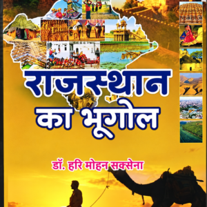
Rajasthan Geography
Rajasthan Geography is particularly important for RPSC and Rajasthan state examinations. Candidates may need detailed knowledge of:- Physical divisions
- Climate
- Rivers
- Lakes
- Soils
- Natural vegetation
- Agriculture
- Minerals
- Industries
- Population
- Transport
- Water resources
Physical Divisions of Rajasthan
Rajasthan can be understood through broad physical regions such as:- Western Desert
- Aravalli Range
- Eastern Plains
- Southeastern Plateau
- Relief
- Rainfall
- Soil
- Vegetation
- Agriculture
- Settlement
Thar Desert
The Thar Desert is one of Rajasthan's most distinctive geographical regions. Important characteristics may include:- Low rainfall
- Sand dunes
- Arid climate
- Sparse natural vegetation
Aravalli Range
The Aravalli Range is one of the major physical features of Rajasthan. It influences:- Drainage
- Relief
- Climate
- Mineral distribution
- Settlement patterns
Rivers of Rajasthan
Rajasthan contains both perennial and seasonal drainage systems. Important rivers may include:- Chambal
- Banas
- Luni
- Mahi
- Source
- Flow direction
- Tributaries
- Drainage basin
- Economic significance
Lakes of Rajasthan
Rajasthan has several important natural and artificial lakes. Students may encounter:- Sambhar Lake
- Pushkar Lake
- Pichola Lake
- Jaisamand Lake
- Ana Sagar
- Location
- Type
- Main characteristic
- Economic or cultural significance
Climate of Rajasthan
Rajasthan generally has a dry climate, but rainfall and temperature vary considerably across the state. Important factors include:- Distance from sea
- Aravalli orientation
- Monsoon influence
- Desert conditions
Soils of Rajasthan
Different parts of Rajasthan contain different soil types. Students may need to understand:- Desert soils
- Alluvial soils
- Black soils
- Red and yellow soils
- Relief
- Climate
- Parent material
Agriculture in Rajasthan
Agriculture in Rajasthan is influenced strongly by water availability and rainfall. Important crops may include:- Bajra
- Wheat
- Mustard
- Pulses
- Cotton
- Maize
Irrigation and Water Resources
Water is one of the most important geographical issues in Rajasthan. Students may study:- Canals
- Wells
- Tube wells
- Dams
- Rainwater harvesting
Minerals of Rajasthan
Rajasthan is important for several mineral resources. Depending on the syllabus, students may study minerals such as:- Zinc
- Lead
- Copper
- Gypsum
- Limestone
- Marble
Industries of Rajasthan
Industrial development can be connected with:- Mineral resources
- Agricultural products
- Transport
- Energy
- Markets
- Cement
- Textiles
- Mining
- Stone industries
- Handicrafts
Environmental Geography
Environmental Geography studies the interaction between humans and natural systems. Important issues may include:- Pollution
- Deforestation
- Desertification
- Climate change
- Soil degradation
- Water scarcity
- Biodiversity loss
- Causes
- Consequences
Desertification
Desertification refers to land degradation in dry regions caused by combinations of climatic and human factors. Possible causes include:- Overgrazing
- Vegetation loss
- Soil erosion
- Unsustainable land use
Climate Change
Climate change affects:- Temperature
- Rainfall
- Glaciers
- Sea levels
- Agriculture
- Ecosystems
Cartography
Cartography is the science and art of map-making. Students may study:- Scale
- Direction
- Symbols
- Projection
- Contours
Map Scale
Scale shows the relationship between map distance and actual ground distance. Scale may be represented through:- Statement
- Representative fraction
- Graphic scale
Contours
Contours connect points of equal elevation. They help represent relief on maps. Students should understand how contour patterns can indicate:- Slopes
- Hills
- Valleys
- Ridges
Remote Sensing
Remote Sensing involves gathering information about Earth's surface without direct contact. Common sources include:- Satellites
- Aircraft
- Sensors
- Agriculture
- Weather
- Forestry
- Water resources
- Disaster management
- Urban planning
Geographic Information Systems
GIS is used to store, analyse and display geographically referenced information. A GIS can combine layers such as:- Roads
- Population
- Rivers
- Land use
- Elevation
Geography for RAS and Other Civil Services
Geography supports several areas of RAS and civil-service preparation. Candidates may need to study:- Physical Geography
- Indian Geography
- Rajasthan Geography
- Resources
- Agriculture
- Population
- Environment
Geography for RPSC Teaching Exams
RPSC teaching examinations may require detailed subject understanding. Candidates may need to prepare:- Physical Geography
- Human Geography
- Indian Geography
- Rajasthan Geography
- Economic Geography
- Environmental Geography
- Practical Geography
Geography for UGC NET, SLET and Assistant Professor Exams
Academic Geography examinations may require deeper preparation in:- Geographical thought
- Geomorphology
- Climatology
- Oceanography
- Human Geography
- Economic Geography
- Population Geography
- Regional Planning
- Quantitative techniques
- Remote Sensing
- GIS
- Compare geographical theories
- Understand models
- Interpret maps
- Analyse spatial patterns
- Apply geographical concepts
- Understand statistical methods
Where Geography Students Lose Marks
Students often lose marks because they:- Memorise locations without maps
- Confuse weather and climate
- Mix weathering with erosion
- Learn rivers without tributaries or basins
- Ignore physical processes
- Memorise crops without climatic conditions
- Mix mineral locations
- Ignore Rajasthan maps
- Confuse population concepts
- Learn theories without understanding their application
- Avoid practical Geography
- Use outdated statistical information without verification
- Maps
- Rivers
- Climate
- Soils
- Crops
- Minerals
- Industries
- Rajasthan Geography
- Important geographical theories
- Frequently confused concepts
How to Study Geography for Competitive Exams
Use Maps Regularly
Mark:- Rivers
- Mountains
- Plateaus
- Minerals
- Industries
- Agricultural regions
Understand Processes
Ask why a landform, climate or population pattern exists.Connect Topics
For example: Climate → Soil → Vegetation → Agriculture This reduces memorisation.Use Diagrams
Draw:- Plate boundaries
- River landforms
- Pressure belts
- Rainfall mechanisms
- Ocean currents
Prepare Rajasthan Separately
Create district-wise and region-wise notes for Rajasthan Geography.Practise Previous-Year Questions
This helps identify recurring areas and required depth.Revise Maps Frequently
Map information can be forgotten quickly without repetition.Important Geography Comparisons for Revision
Students can prepare differences between:- Weather and climate
- Latitude and longitude
- Weathering and erosion
- Fold and block mountains
- Cyclone and anticyclone
- Tropical and temperate cyclones
- Himalayan and Peninsular rivers
- Renewable and non-renewable resources
- Rural and urban settlements
- Immigration and emigration
- Intensive and extensive farming
- Natural vegetation and cultivated vegetation
- Remote Sensing and GIS
- Weather map and physical map
- Meaning
- Characteristics
- Main difference
- Example
- Exam importance